Iceland Weather Explained: How to Predict Clear Skies for Aurora Viewing
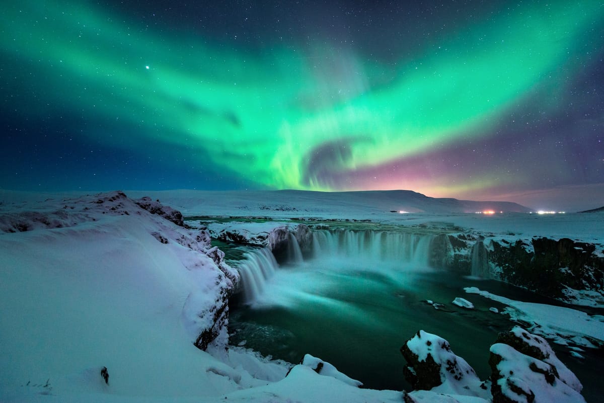
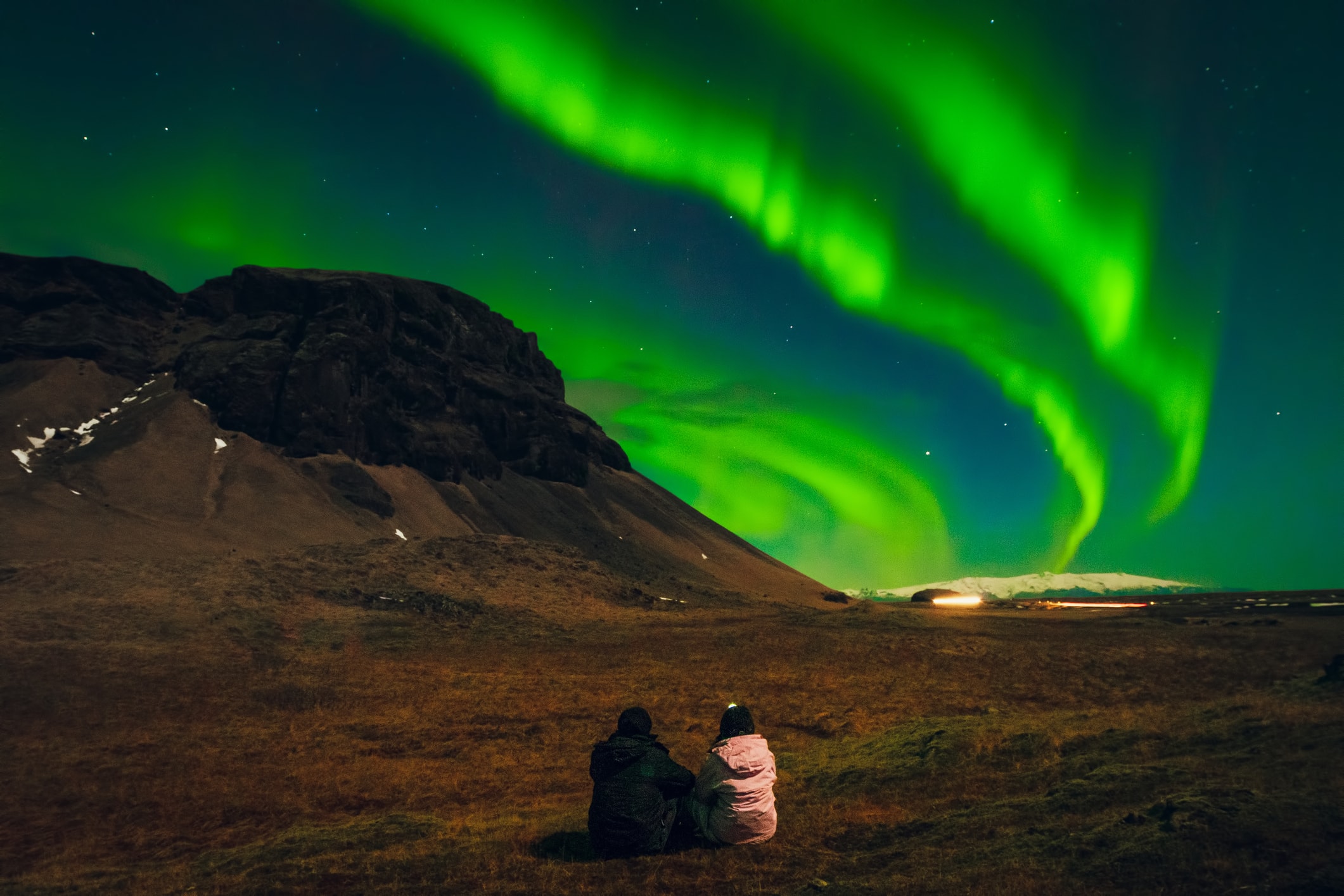
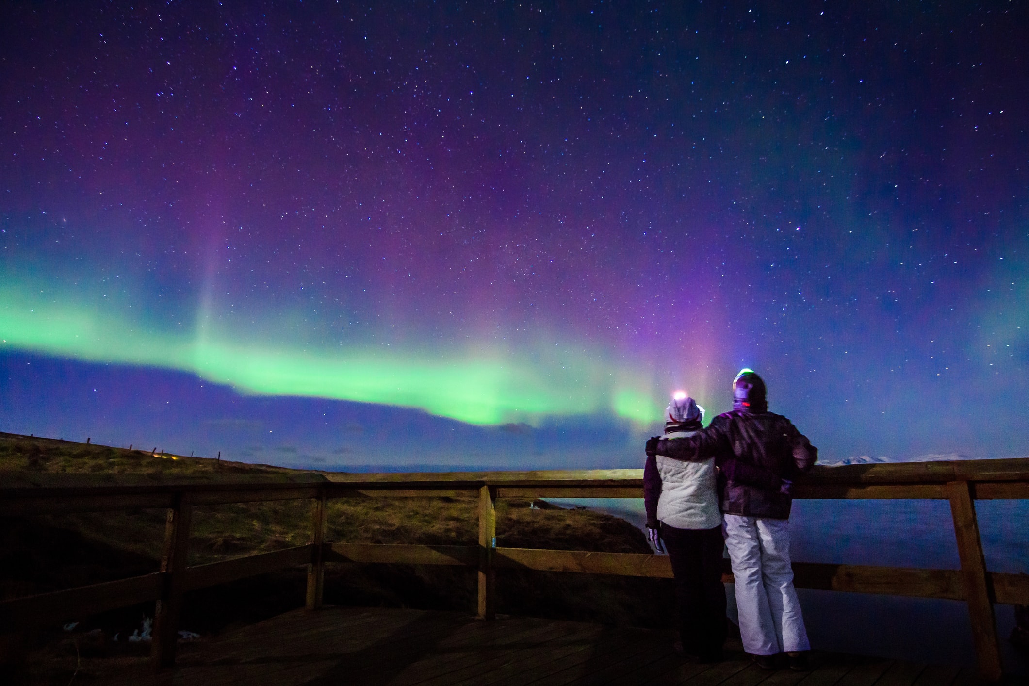
Planning a Northern Lights trip to Iceland can feel like a mix of science and luck. You need geomagnetic activity, darkness, and—most importantly—clear skies.
While the aurora is mesmerizing, local weather often determines whether you see it or not. This guide explores Iceland’s weather systems, cloud patterns, forecasting tools, and regional trends.
You’ll learn how to read the skies, interpret weather maps, and choose the best nights and locations for clear views of the aurora. Think of it as your meteorology guide to aurora hunting—because even with strong solar activity, clouds can ruin the show.
Let’s get started.
1. Iceland’s Climate & Weather Systems: Why Clear Skies Are Rare
Maritime & Polar Influence
Iceland lies at a crossroads of oceanic and Arctic influences. The North Atlantic Current (a branch of the Gulf Stream) brings warmth, moderating winters. At the same time, Iceland is exposed to frequent low pressure systems rolling in from the Atlantic, especially in the south and west coasts.
That mix makes Iceland’s weather volatile: clear skies can vanish in minutes, winds pick up unexpectedly, and cloud banks often dominate. Wikipedia describes that inland and highland areas see abrupt changes, strong gusts, and frequent precipitation.
Elevation & Topography Effects
Mountains, ridges, and coastal fjords influence cloud formation, wind shear, and local microclimates. A valley may remain clear while surrounding hills are shrouded in clouds—or vice versa. In winter, temperature inversions (cold air trapped near the ground with warmer air above) can create low-level fog or clouds, even with clear skies aloft.
Seasonal Variability
- Winter (Nov–Feb): Long nights, highest aurora potential, but also more storm fronts and unstable cloud cover.
- Shoulder months (Sept/Oct, Mar/Apr): You trade somewhat milder weather for more variable skies—but these periods often deliver clearer breaks due to more stable transitions between seasons.
- Summer (May–Aug): Too bright for auroras. Even twilight prevents true darkness. Perlan notes that active auroras are extremely unlikely in mid-summer.
Iceland’s weather is also more stable in the east & north on some days, especially when westerly systems bypass the interior.
2. Clouds and Visibility: Types, Layers & Impact on Aurora
Cloud Altitude Layers (Low / Mid / High)
- Low clouds (base often 0–2 km): Most dangerous for aurora watchers because they block nearly all sky light.
- Mid clouds (2–5 km): May partially obscure, but gaps sometimes allow auroras to show through.
- High clouds (5+ km, cirrus, thin clouds): Can dim or soften auroras but often still allow them to be visible.
On the Icelandic Met Office aurora forecast, you’ll see separate maps for low, mid, and high cloud layers, plus a composite. Green shading = cloud, white = clear skies.
Cloud Movement & Dynamics
Clouds shift with wind aloft. Often, cloud gaps drift across regions over hours. A spot with partial mid/high clouds could see breaks during the night. That’s why static forecasts are less reliable; live updates and cloud movement are key.
Moisture, Humidity, & Fog
On still, humid nights, ground fog or stratus can form and kill visibility even with clear skies above. Also, coastal mist can blur aurora edges. Dry, cold nights tend to have crisper skies.
Solar Illumination & Twilight Effects
Even after sunset, residual twilight may linger, especially near equinox seasons. The sky must be sufficiently dark for weaker auroras to show. The satellite or forecast maps often shade the daylight side, telling you when hours of darkness begin.
3. Atmospheric & Space Weather Variables That Matter
Clouds are only part of the puzzle. Even a "clear sky" night may be blank if solar conditions aren’t favorable. Here are the other factors:
Geomagnetic Activity & the KP Index
The KP index (0–9) is the classic measure of geomagnetic disturbance. A higher KP implies more particles pushing into Earth’s magnetic field and increased aurora intensity. But in Iceland’s latitude, even KP 2 or 3 can yield visible auroras—given clear skies. Iceland often lies beneath the auroral oval, so lower KP values still matter.
Interplanetary Magnetic Field (IMF) / Bz Component
A key variable is Bz, the north-south orientation of the solar wind’s magnetic field. When Bz is negative (southward), it allows more energy coupling into Earth’s magnetosphere, increasing aurora likelihood. Many aurora forecasting guides emphasize monitoring this in real time.
Solar Wind Speed, Density, & Bt
- Solar wind speed: Higher speeds deliver more charged particles faster, boosting aurora chances.
- Particle density: Denser streams pack more material to energize the upper atmosphere.
- Bt (total magnetic field strength): The stronger the Bt magnitude, the more forceful the geomagnetic coupling.
When wind is fast, Bz is negative, density high, and Bt elevated—conditions align for potential aurora.
Hemispheric Power / Aurora Oval Models
Tools like Ovation or "auroral oval" models map where aurora is strongest. Iceland-specific sites (e.g. AuroraForecast.is) combine these with weather data.
IcelandAtNight explains that Iceland is nearly always beneath the auroral oval; thus, cloud cover becomes a gating factor more often than whether auroras exist at all.
4. Forecasting Tools & Reading the Maps
Key Icelandic Forecast Sources
- Icelandic Meteorological Office (Vedur.is)
Their aurora forecast interface shows cloud layers, aurora (Kp) values, and time sliders. Green = cloud, white = clear. - Perlan’s Aurora Forecast
Simple interface with aurora strength and cloud overlay; good real-time snapshot. - AuroraForecast.is / Northern Lights Research Center
Combines space weather and geomagnetic data specifically for Iceland forecasts. - Adventures.is / northernlightsiceland.com / Fire & Iceland
Tourist-focused forecasts combining KP and cloud cover with simplified maps. - NOAA / SWPC / Space Weather Prediction Center
Global indices and aurora oval predictions (useful as supporting data).
How to Read a Forecast Map (Step by Step)
- Select Iceland and the date/time window (e.g. 22:00–02:00).
- Load cloud layers (low, mid, high, composite).
- Overlay aurora or KP forecast (often a map or value).
- Check solar metrics (if available): Bz, solar wind speed, density.
- Check darkness windows (sunset, moonrise) to ensure time is dark enough.
- Slider / time animation: Move the time slider to see cloud movement over night.
- Highlight "white" zones (clear) in the composite cloud map that overlap with decent KP areas.
- Pick two candidate directions (if map shows two white patches), prepare to pivot.
- Cross-check local reports / real-time data (e.g. IcelandAtNight, Auroral sightings).
The “blue is day / black is night” shading often shows where darkness begins and ends on multi-hour forecast maps.
Confidence, Uncertainty & Real-World Behavior
Forecasts are probabilistic. A map showing cloud cover is a snapshot; local microclimates may diverge. Aurora forecasts are often only 2–3 days reliable; space weather may shift. IcelandAtNight warns that Kp is a rough guide—clouds often kill otherwise good nights.
As one Reddit guide stated:
“There are 3 most important criteria … Dark days. Clear skies. High solar activity.”
Thus, always plan for flexibility and multiple nights.
5. Decision Workflow: Choosing Clear-Sky Nights
Here’s a decision tree you can follow when planning or during your trip:
| Step | What to Check | What Indicates Go / Pivot | Notes |
|---|---|---|---|
| 1 | Season & Night Length | Better between September–April, darkest midwinter | Perlan’s monthly guide shows which months are viable. |
| 2 | Aurora / KP Forecast | KP ≥ 2 is promising; KP ≥3 is better | Kp 0 or 1 may still produce faint lights under ideal skies. |
| 3 | Cloud Composite & Layers | White zones (clear) over acceptable KP areas | If “cloud” zones cover, pivot early. |
| 4 | Solar Parameters | Bz negative, high solar wind speed/density | If Bz is consistently north, skip or stay flexible. |
| 5 | Darkness / Moonlight | Night must be dark and minimal moonlight | Moon phases and twilight influence visibility. |
| 6 | Local Microclimate | If patchy clouds, plan to move to clear zone | Sometimes 10 km shift brings you under clear sky. |
| 7 | Final Decision | Go if combined indicators align | If not, reschedule, wait, or run backup plan. |
Use this approach nightly rather than relying on a single forecast.
6. Local Patterns & Seasonal Tendencies
Known “Clear Sky Corridors”
- Reykjanes Peninsula / West Coast: sometimes clears while interior remains cloudy.
- East Iceland: more stable in some weeks when Atlantic systems bypass the east.
- Northern Peninsula / Westfjords: when southwestern systems dominate, these remote zones may see clearer skies.
- Þingvellir / Highland gaps: occasional gaps open near interior rift zones.
Months with Higher Clear-Sky Probability
- October / March: often drier, transitional weather, more stable nights.
- November / February: long nights but also higher storm front frequency.
- December / January: darkest but most volatile in clouds.
- Late August / early September: nights deepen, though rain risks higher.
Wind Patterns & Cloud Clearing
Strong westerly winds often bring cloud banks from the Atlantic. But once they pass, clearings may follow behind. Monitoring high-altitude wind shear can hint at rapid cloud clearing zones.
Temperature Inversions & Radiation Cooling
On calm nights, ground cools faster than upper air, leading to fog or low cloud formation over valleys. Avoid these areas if possible; look for ridges or slopes.
Practical Tips, Pitfalls & Backup Plans When It’s Cloudy
Cloudy skies can put a damper on your outdoor plans, but don't let them ruin your night! Here are a few tips and backup plans to help you out.
Don't Commit Too Early
If the forecast looks grim and the webcams aren't showing any clear skies, maybe don't drive for hours to that one specific spot just yet. It's often better to wait for evening updates. A little patience can save you a lot of driving and disappointment.
Be Willing to Move Around
Chasing the aurora is all about being flexible. Keep an eye on the cloud maps and be ready to hop in the car and drive toward any clear patches you see. Sometimes, just driving 20-30 km down the road can be the difference between seeing the lights and seeing just clouds.
Look Up!
What do you see right above you? If you can spot a few stars early in the evening, that's a good sign, even if the forecast calls for clouds. Many experienced aurora chasers say that if you can see stars, you have a decent shot at seeing the aurora through a break in the clouds.
Know When to Call It a Night
Persistence is great, but sometimes the weather just won't cooperate. If you've been waiting for an hour or so and the clouds are thick with no sign of breaking, it might be time to pack it in. There's no shame in heading back and trying another time.
You can always switch to your backup plan, like checking out a local museum, catching a show, or grabbing a nice dinner. That way, the night's not a total loss.
Take Notes
Even if you don't see the aurora, snap a few photos of the cloud maps and your surroundings. Later, you can compare them to what actually happened. This is a great way to get better at reading weather patterns for next time.
Stay Warm and Comfy
You can have the clearest sky in the world, but if you're freezing, you won't enjoy it. Always dress in layers, even if it doesn't feel that cold at first. Bring extra batteries for your camera and phone, toss some hand warmers in your pockets, and don't forget your rain gear—cloudy nights can get damp.
Have a Backup Plan
Sometimes, the clouds just won't budge. On nights like those, having a fun indoor activity planned can save the evening. Think about visiting a museum, soaking in a geothermal pool, checking out a lava show, or even seeing an aurora simulation at a planetarium. This way, you still have a great night, with or without the northern lights.
Example Forecast Breakdowns & Analysis
Ready to become a master aurora chaser? Practice these nightly scenarios to sharpen your intuition and spot those elusive northern lights!
Example 1: Moderate KP, Patchy Clouds – Your Adventure Begins
- KP forecast: A promising 3
- Cloud composite: Mostly clear skies westward and northward, with some mid-level clouds lingering in the east.
- Solar data: A gentle negative Bz window from 22:30–23:30 – our prime viewing slot!
- Your Action Plan: Head out west/north, find your perfect spot by 22:00, and keep an eagle eye on cloud movements. Be ready to pivot if those clouds decide to dance!
Example 2: High KP, But a Wall of Clouds – The Ultimate Challenge
- KP forecast: A thrilling 5!
- Cloud composite: A stubborn, thick blanket of low clouds covering most areas.
- Solar data: Strong negative Bz and high-speed solar wind – the potential is immense!
- Your Action Plan: Stay patient! Check the skies around 21:00. Be prepared for a spontaneous dash, driving 30–40 km to find that elusive clear gap. If the clouds refuse to budge, have a cozy indoor alternative ready.
Example 3: Low KP, But Pristine Skies – A Serene Opportunity
- KP forecast: A humble 1–2
- Cloud composite: Nearly 100% crystal-clear skies.
- Solar data: No significant southward Bz – low activity expected.
- Your Action Plan: Don't write it off! Still venture out. Even faint aurora can appear, especially shimmering near the horizon. Perfectly clear skies can reveal the most delicate whispers of light.
Embrace these nightly exercises to build your intuition and become an aurora prediction pro. The more you practice, the more magic you'll witness!
Make It Effortless: Private Northern Lights Tours with Lagoon Stops
If you’d rather avoid the challenge of interpreting complex weather maps, chasing forecasts, and driving into Iceland’s unpredictable winter nights, The Iceland Tour Co. offers private Northern Lights tours designed for comfort and success.
Each private experience includes a professional local guide who monitors real-time weather and aurora conditions, choosing the best direction for clear skies. You simply relax while your guide handles logistics, timing, and navigation — maximizing your chances of seeing the aurora.
What makes these tours truly special is the opportunity to combine your chase with a geothermal lagoon visit. You can enjoy a warm soak before or after the aurora hunt at one of Iceland’s stunning spas:
- Sky Lagoon – A luxurious ocean-edge retreat just outside Reykjavík, ideal for those who want to unwind before their aurora evening.
- Hvammsvík Hot Springs – Nestled in a quiet fjord with little light pollution, it offers one of the best spots to see the Northern Lights reflected over still waters.
- Laugarás Lagoon – Iceland’s newest geothermal lagoon near the Golden Circle, where its rural setting provides excellent aurora visibility and tranquil surroundings.
With The Iceland Tour Co., you skip the stress of planning and gain a tailored adventure led by experts who know when — and where — Iceland’s skies are most likely to clear. It’s the most relaxing way to turn weather uncertainty into a night of unforgettable beauty.
FAQs
How does Iceland’s weather affect Northern Lights visibility?
To see the Northern Lights in Iceland, watch both the weather forecast and cloud cover forecast. Clear or partly clear skies and minimal light pollution give the best view of the aurora borealis, especially during winter months. Areas like Þingvellir National Park and the South Coast offer dark skies ideal for auroral displays.
What tools help predict clear skies for aurora viewing?
Use real time aurora forecast maps and cloud cover maps from reliable sources. Green or light green areas show clear skies, while light yellow means partial clouds. Checking the kp index forecast and bz value reveals aurora activity strength near magnetic poles.
When is the best time frame for viewing the aurora?
The Northern Lights season runs from late autumn to mid-April. During long night sky hours in the northern hemisphere, auroral activity peaks. Avoid city lights to enjoy stronger auroral displays.
Can solar activity help predict aurora strength?
Yes. Coronal holes and extreme geomagnetic storms increase the planetary index number (KP), enhancing the natural phenomenon. Higher kp numbers mean brighter, widespread auroras—making it the perfect time to visit Iceland or join a Northern Lights tour near the Arctic Circle.
Conclusion
Clear skies are the final gatekeeper to aurora magic—and Iceland makes that gate challenging.
But when you understand clouds, storms, solar winds, and local patterns, you can tilt the odds in your favor.
Use the maps, anticipate cloud behavior, stay flexible, and chase the breaks rather than the whole sky. Even in a season filled with storms, there are clear windows—and you’ll be ready when they open.